
Walk the Stamford Street Directory Trail
A Stamford street directory search works best as a fixed chain. Start with the street number and name, then preserve every key that can survive a spelling change. The Stamford assessor supplies the owner and parcel clues. The deed index supplies the recorded transfer. The voter system adds a narrow civic layer. A Stamford historical directory can show how the same address was described before the current street grid or postal system.
That order keeps a Stamford street search grounded. It does not turn a map, owner field, or voter result into a claim about every person at a Stamford address.
- Enter the Stamford address in Vision and save the situs, owner, mailing block, PID, MBLU, account, and book/page reference.
- Search the Stamford owner as a grantee in SearchIQS, then read the deed to identify the seller and prior legal description.
- Use the Connecticut voter status route or ask the Stamford Registrar about a specific public list; it is not a streetwide name download.
- Check a Stamford directory, obituary, census, or yearbook for the address and year, including older street spellings.
- Compare the Stamford historical clue with the parcel and deed keys before treating it as a past household match.
Stamford Records Along One Street
Address records in Stamford are spread across systems with different purposes. A parcel card names an owner of record. GIS shows physical and district context. The Town Clerk index shows recorded parties. Tax, permit, voter, and historical sources add separate signals.
| Record set | Keeper | What it shows | Access |
|---|---|---|---|
| Stamford assessor parcel | Stamford Assessor / Vision | Owner, situs, mailing address, value, building and land data | Free web search |
| Stamford GIS parcel layer | Stamford GIS | Parcel shape, address, MBL, neighborhood and district context | Viewer and REST service |
| Stamford deeds, liens, maps | Town Clerk / SearchIQS | Grantor, grantee, legal description, recording and prior references | Index, images, vault, copies |
| Stamford tax account | Stamford tax collector / MyTaxBill | Bill, account, property, DBA and payment identifiers | Free search; payment stage differs |
| Stamford permits and land use | OpenGov / ViewPoint / city offices | Applicant, address, project, plans, approvals and inspection clues | Portal or focused FOI request |
| Stamford voter record | SOTS / Registrar | Released registration, district, party and list-maintenance fields | Individual lookup or written request |
| Stamford directory and obituary | Ferguson and History Center | Past household, address, occupation, relatives, notice and street clues | Microfilm, archive, library or licensed database |
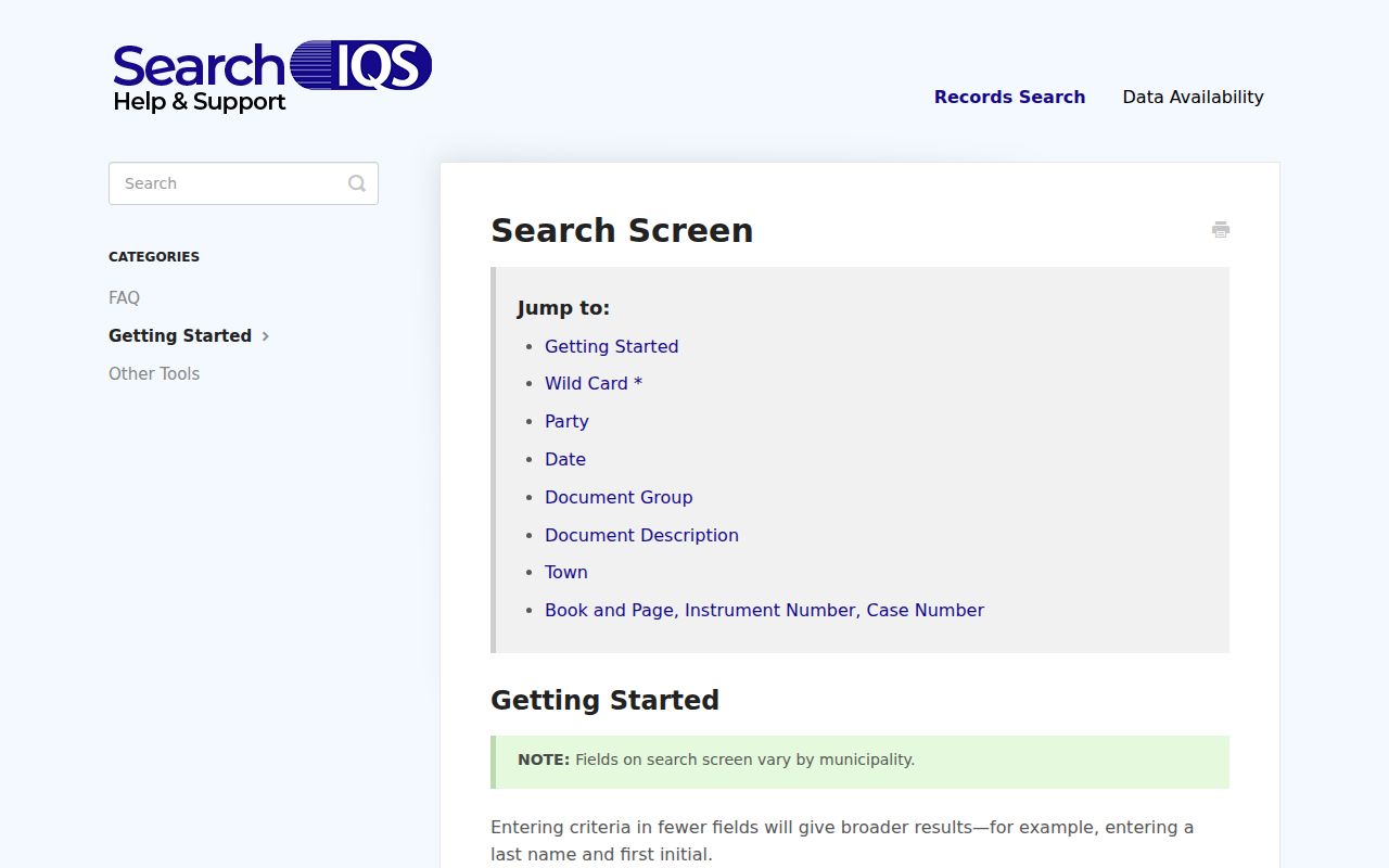
The SearchIQS field guide records the party, date, document, book/page, instrument, and case-number controls used for deed-index work.
The useful Stamford chain is parcel to owner to deed to older name. A tax account can confirm that a property key is active, while a permit can explain a change at the address. Each source should retain its date, key, and access limit.
Search Stamford Street Parcels in Vision
Stamford Vision’s form is the main address-to-owner tool. It accepts address, owner, account, MBLU, PID, and all-fields modes, with street listing and sales search as browse routes. A partial street or owner entry can bring up suggestions, which helps when a Stamford name has more than one spelling.
The Stamford assessor parcel sample shows the result card behind the search form.
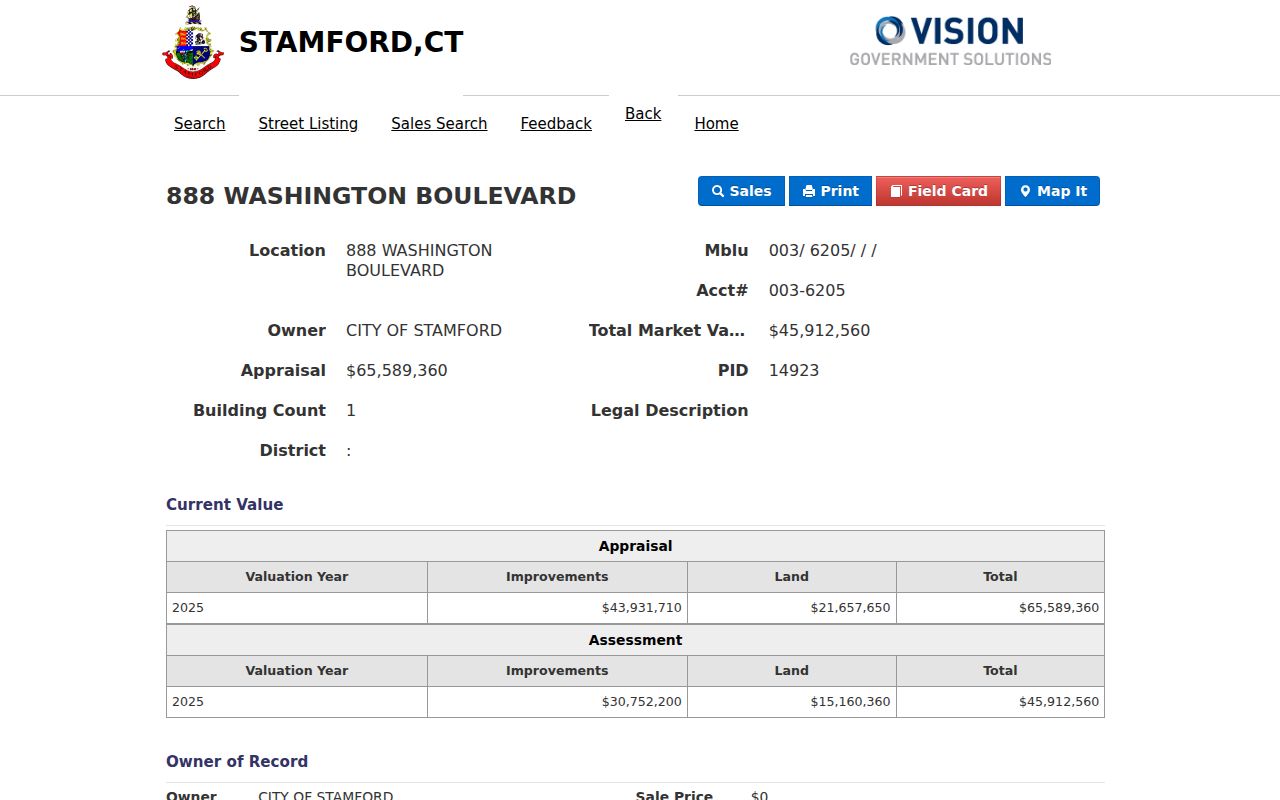
The inspected Stamford card for City Hall separates the 888 Washington Boulevard parcel from its owner mailing block and includes PID 14923, MBLU 003/6205////, account 003-6205, book/page 2819/0180, a 1986 sale date, and building and land fields. Those Stamford values are useful handoffs, not proof of occupancy.
| Field label | Type | Required | Options or format notes |
|---|---|---|---|
| Stamford Vision: Search | Dropdown | Yes | Address, Owner, Acct#, Mblu, PID, or All. |
| Stamford Vision: Address | Text/autocomplete | Conditional | Address suggestions activate at about three characters. |
| Stamford Vision: Owner | Text/autocomplete | Conditional | Owner last name or partial match. |
| Stamford Vision: Acct# | Text/autocomplete | Conditional | Account identifier, with a pattern such as 003-6205. |
| Stamford Vision: Mblu | Three-part text | Conditional | Map, block, and unit fields; blanks can mark subunits. |
| Stamford Vision: PID | Text | Conditional | Numeric parcel identifier. |
| All | Text/autocomplete | Conditional | Searches across the available fields. |
| Street Listing | Tab or link | Browse | Streets.aspx browse path. |
| Sales Search | Tab or link | Browse | Sales.aspx search path. |
The Stamford portal script contains a Past Owner path, but that choice was not visible in the current form. Use it only if the live interface displays it, and use deeds for a confirmed ownership chain.
Situs and Mailing Addresses Differ
A Stamford situs address is the physical location of the taxable parcel. A mailing address is where the owner, trust, company, or tax recipient receives mail. Vision and the statewide CAMA layer can show both. They may match, but they can also point to different places, a post office route, or a different administrative address.
The Stamford sample makes the distinction plain. The parcel location is 888 Washington Boulevard, while the owner mailing block is also shown separately with a Stamford postal line. The Stamford MBLU, PID, account, book/page, and legal description are stronger keys for the next deed search than a mailing line alone.
- Parcel
- The mapped land unit that carries a local identifier and property record.
- Situs address
- The physical address assigned to the parcel or structure.
- Plat
- A recorded map that helps place lots, blocks, lines, or subdivisions.
- Criss-cross directory
- A reverse directory organized by street or address; exact Stamford directory titles and years should be confirmed with staff.
Stamford GIS Shows Parcel Context
The Stamford GIS viewer lets a researcher pan along a street, click a parcel, and collect the address or MBL link for a separate Vision search. It is useful for both sides of a block, corner lots, parcels across a right-of-way, and neighborhood or district context.
The Stamford parcel REST service documents the map layers and actions behind the street view.
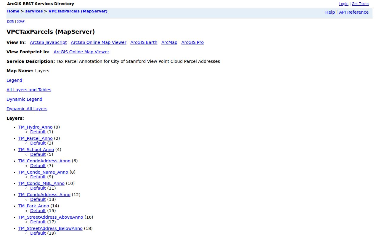
Its Stamford layers include parcels, address and MBL annotation, condo address and name, streets, parks, and related context. Identify, Query, Find, and Export actions can return JSON, geoJSON, or PBF results, with a service maximum of 1,000 records. The Stamford city warning says tax-map boundaries are approximate and do not replace a deed or survey.
MBLU and PID Beat Street Spelling
Stamford street text is fragile. An old number, a shortened suffix, a renamed road, or a different unit mark can break a name-only search. MBLU, PID, and account values give a more stable bridge from Vision to GIS and then to the Town Clerk index.
Stamford flow: address search, normalized parcel, MBLU or PID, owner card, book/page, deed image, prior legal description.
Save the keys before moving between sites. If a current Stamford street name fails in an older deed, search the legal description, map or lot reference, seller name, and former street name. A parcel key can connect records even when the address line does not.
Stamford Address Permits Need an FOI Fallback
Stamford’s public permit shell describes construction, renovation, electrical, plumbing, heating or air-conditioning, demolition, and related inspection work. The Stamford OpenGov and ViewPoint portal is dynamic, and a public historical search with complete filters, dates, result fields, and export behavior was not exposed in the inspected capture.
For a Stamford permit tied to a street, start with the parcel and address, then ask the Building Department or Land Use Bureau for the permit card, application, plan, or decision under the Connecticut Freedom of Information Act. A focused request should name the address, PID or MBLU, project type, date range, and preferred electronic format. It should not ask for every record about a person.
The Stamford city describes OpenGov payment for zoning fees, while specified Planning Board, Zoning Board, Environmental Protection, and Zoning Board of Appeals applications use checks. A missing public result is therefore a reason to ask the custodian, not a reason to assume that no permit exists. Request inspection first, then copies of the exact card or plan needed.
The Stamford Voter Layer Is Separate From Street Records
A Stamford voter record is not an assessor record. Connecticut’s centralized system can expose a released name, residence address, district, party, active or inactive status, and participation history, but the public web route is an individual status check. Stamford’s voting-location tool uses street number and street name to return an election place, not a list of nearby voters.
Section 9-50d protects Social Security, license, identity-card, and safety-suppressed address fields. The Stamford Voter Registry Privacy Program and Safe at Home can keep a legitimate record from appearing in the way a street search expects. A specific list or statewide file requires a written route through the Registrar or SOTS, and the statewide file request is listed at $300.
Old Stamford Names Break Searches
A modern Stamford street line can hide the name used by a directory, map, or deed. The Stamford History Center’s Lost Streets exhibit ties downtown renewal to address continuity clues. St. John’s Place appears in the 1893/94 directory. Hawthorne was Meadow, Tresser was School, Cottage appears on an 1851 map, and Holly Place first appears in the 1914 directory.
Keep both forms in a Stamford search note. A house-history or former-resident question may need the modern parcel key first, then an older street spelling, directory year, Sanborn sheet, or map. That is also why the Stamford city directories collection deserves a separate historical pass instead of being treated as a current street list.
ZIP Anomalies on Stamford Parcels
ZIP is a postal key, not a city-limit test. The core Stamford sequence is 06901 through 06907, but the 2025 Connecticut CAMA parcel layer also returned Stamford-town property ZIP values 06807, 06820, 06830, 06831, 06840, and 06870. Those Stamford edge values show why a street directory should keep the parcel Location and mailing ZIP as separate fields.
The Stamford tax-bill search illustrates the other side of the issue.
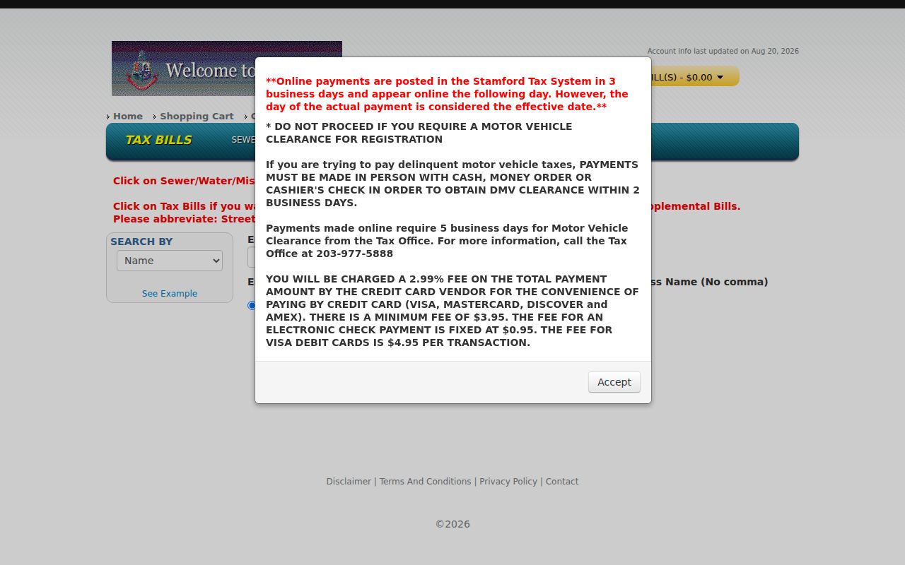
Stamford MyTaxBill searches property number and street, owner or business, bill, account, link, tax ID, and DBA fields, but no ZIP field was observed. Use the USPS ZIP lookup for the final Stamford delivery ZIP and CAMA or Vision for the parcel relationship. CAMA counts are parcel rows, not population or a list of current occupants.
Stamford Transfers and Fraud Alerts
A Stamford deed trail also has a timely safety layer. The Stamford property-fraud alert form is described as a free email alert when a deed, mortgage, or similar instrument is indexed under a watched name. A same-name alert is not proof that the document belongs to the subscriber, so open the record and compare the parties, book/page, and legal description.
The Stamford Town Clerk’s property-transfer PDFs provide another current lead, while the land-record vault remains the counter route for an index, map, or certified copy. For an older Stamford street, the Ferguson Library history collection and Stamford History Center can supply microfilm, maps, directory pages, and house-history leads. Call the Town Clerk at 203-977-4054 before relying on a suspicious notice. A real record has a custodian, a source date, and a trail back to the recorded instrument.
What a Stamford Street Directory Cannot Show
No Stamford street directory supplies a complete list of every person connected to a parcel. Owner data can reflect title, a mailing recipient, a trust, a company, or an institution. A voter may be protected. A historic entry may describe a former household. Utility customer data and motor-vehicle address data are not open streetwide lists.
Use a Stamford map as geography, an assessor card as an ownership clue, a deed as a title record, a voter result as a limited civic signal, and a directory as historical context. Separate those roles before drawing a conclusion about a person or address.
Lawful personal use. Stamford address records are available for lawful personal research, family history, property curiosity, and civic work. Do not use a street trail to stalk, harass, intimidate, or harm anyone, and do not publish sensitive details merely because a record was accessible.