
Stamford ZIP Code Directory Coverage at a Glance
The operational Stamford sequence in Fairfield County is 06901 through 06907, but the parcel data adds a second layer. The Stamford table keeps delivery labels apart from Property_Zip anomalies returned for parcels whose Town_Name is Stamford. Stamford station names are useful checks, not legal boundary lines.
| ZIP Code | Areas Covered | Post Office | Notes |
|---|---|---|---|
| 06901 | Downtown, central Stamford, Atlantic, Bedford, and the civic core | Summer Atlantic, 550 Summer Street | CAMA: 398 parcel rows |
| 06902 | South End, Shippan, Waterside, and harbor or east-south corridors | West Ave, 317 West Avenue | CAMA: 9,934 parcel rows |
| 06903 | North Stamford, northern ridges, and rural-suburban roads | Exact delivery office varies | CAMA: 5,652 parcel rows |
| 06904 | Stamford postal sequence and special delivery use | Verify the submitted address with USPS | No current property row located in the inspected CAMA output |
| 06905 | West Side, Westover, and west-central corridors | Bulls Head, 19 High Ridge Road | CAMA: 5,268 parcel rows |
| 06906 | Glenbrook, east-central Stamford, and adjoining residential streets | USPS Glenbrook, 370 Hope Street | CAMA: 1,882 parcel rows |
| 06907 | Springdale and northeast or east Stamford around Hope Street and Newfield routes | USPS Camp Avenue, 24 Camp Avenue | CAMA: 2,276 parcel rows |
| 06807 | Redding or Georgetown postal area on a small set of Stamford-town parcels | Verify exact delivery address | CAMA: 26 property-ZIP parcel rows |
| 06820 | Darien postal area on Stamford-town parcels | Verify exact delivery address | CAMA: 64 property-ZIP parcel rows |
| 06830 | Greenwich or Old Greenwich postal area on Stamford-town parcels | Verify exact delivery address | CAMA: 11 property-ZIP parcel rows |
| 06831 | Greenwich postal area on Stamford-town parcels | Verify exact delivery address | CAMA: 117 property-ZIP parcel rows |
| 06840 | New Canaan postal area on Stamford-town parcels | Verify exact delivery address | CAMA: 39 property-ZIP parcel rows |
| 06870 | Old Greenwich postal area on Stamford-town parcels | Verify exact delivery address | CAMA: 49 property-ZIP parcel rows |
The Stamford CAMA figures are parcel rows only. They are not population figures or proof that USPS assigns one retail counter to every address. Six inspected Stamford rows had no property ZIP, another reason to verify the Stamford address.
Note: A Stamford ZIP label narrows a search, but the Stamford parcel Location and legal description remain the stronger municipal keys.
The official Connecticut CAMA and Parcel Layer is the source for the statewide parcel view behind the ZIP comparison.
Its Property_Zip and Mailing_Zip fields make it possible to ask whether a postal value belongs to the parcel or to the owner’s mailing record.
Why Stamford Parcels Carry 068xx ZIPs
The 2025 CAMA query for Town_Name equal to Stamford returned 06807, 06820, 06830, 06831, 06840, and 06870 as real Property_Zip values. Those rows show a postal boundary or edge condition inside the town’s parcel dataset. They do not turn a Greenwich, Darien, Redding, or New Canaan delivery label into a Stamford municipal ZIP series.
Use the parcel Location, MBLU, PID, and map position to decide what land record is in scope. A postal value can follow a carrier route or a nearby post office. It can also be tied to a large edge parcel, institution, or mailing arrangement. The CAMA service warns that some towns suppress ownership or replace it with “Current Owner,” so its display may not match the Vision card word for word.
The CAMA parcel feature service exposes the field-level view used to query Property_Zip, Mailing_Zip, Location, ownership fields, valuation, sales, and parcel identifiers.
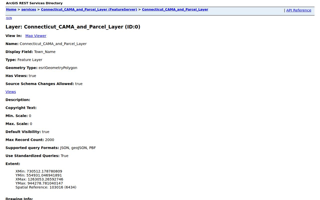
That Stamford service is a parcel dataset, not a ready-made Stamford resident list. Keep its collection date and row count with any ZIP result.
Stamford Property ZIP Versus Mailing ZIP
Stamford Property_Zip belongs to the parcel’s location record. Stamford Mailing_Zip belongs to the address used for an owner or taxpayer. Stamford’s Vision card makes the same distinction with a situs location and an owner mailing block. A company, trust, post office box, or owner who lives elsewhere can make those fields diverge.
| Property_Zip | The postal value attached to the taxable parcel or physical location. |
|---|---|
| Mailing_Zip | The postal value attached to the owner or tax correspondence address. |
| Location | The municipal situs used to identify the Stamford parcel. |
| MBLU or PID | The parcel keys that help carry a search past street spelling or renumbering. |
For a named parcel, open the Stamford Vision assessor search by address, owner, account, MBLU, PID, or All. It has no visible ZIP selector, so a ZIP result from CAMA must be narrowed with an address or parcel key before it becomes a property search.
Stamford USPS Stations Check the ZIP Key
Stamford USPS facility pages help test the operational labels. Summer Atlantic is tied to 06901, West Ave to 06902, Bulls Head to 06905, Glenbrook to 06906, and Camp Avenue to 06907. A Stamford station is a retail or delivery facility, not a claim that its ZIP follows a neighborhood border. The final check belongs in the USPS address tool.
The USPS Summer Atlantic listing supplies the official facility reference for central Stamford.
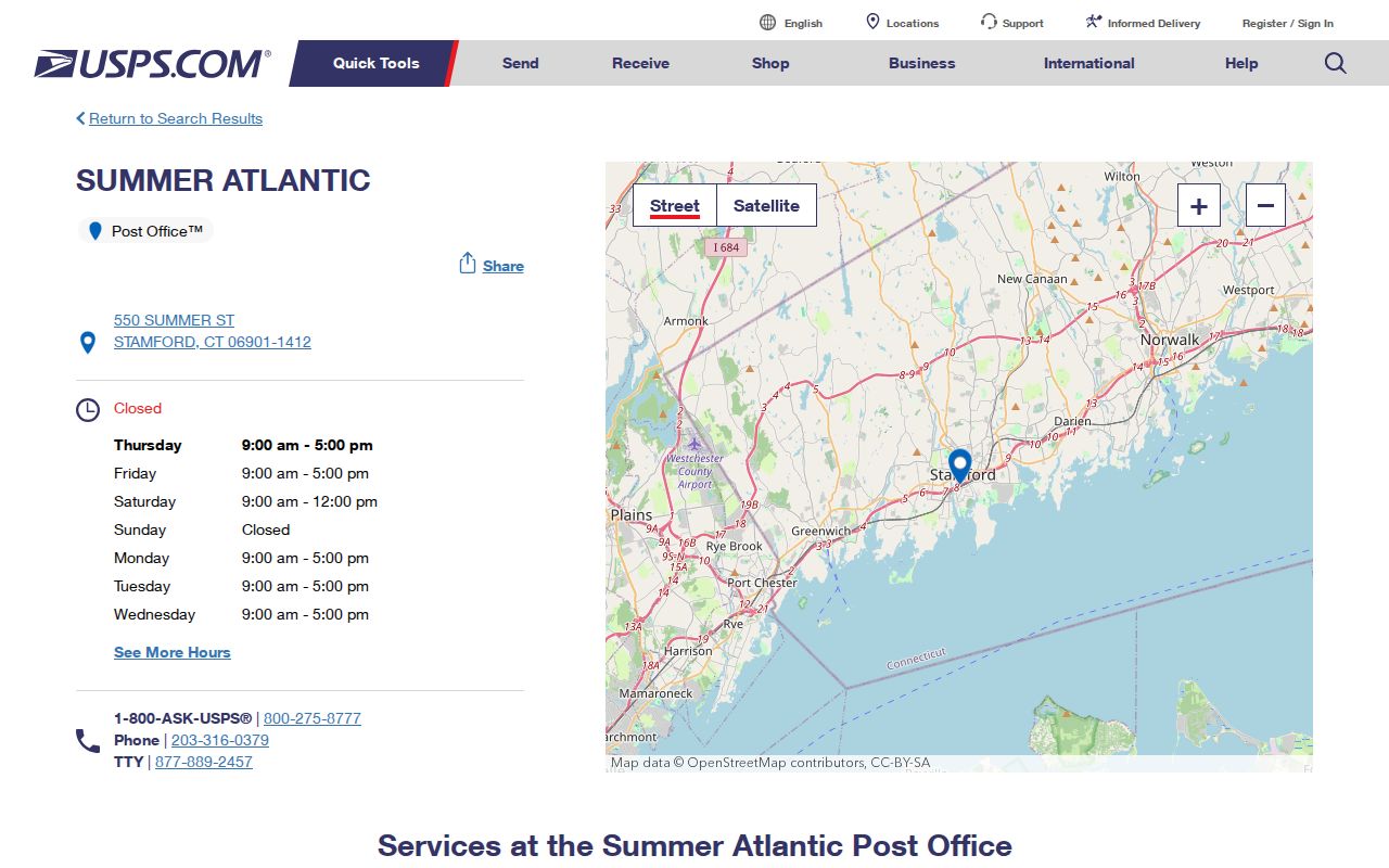
That facility cross-check supports the 06901 label, while the exact address still controls delivery.
The USPS West Ave listing provides the comparable 06902 station reference for South End and harbor-side searches.
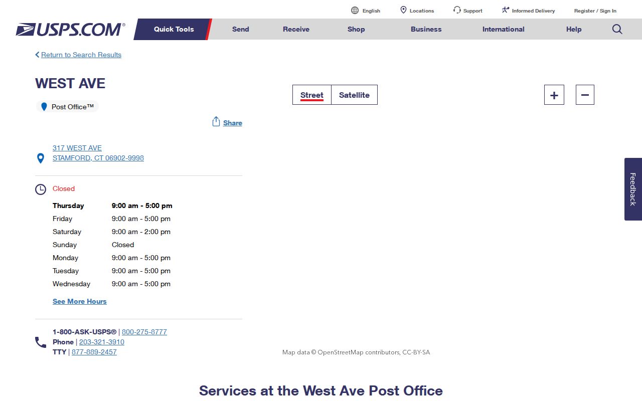
Read the facility page as a delivery clue, then submit the complete street address to USPS before storing a ZIP in a record note.
The USPS Bulls Head listing is the station reference for the 06905 row.
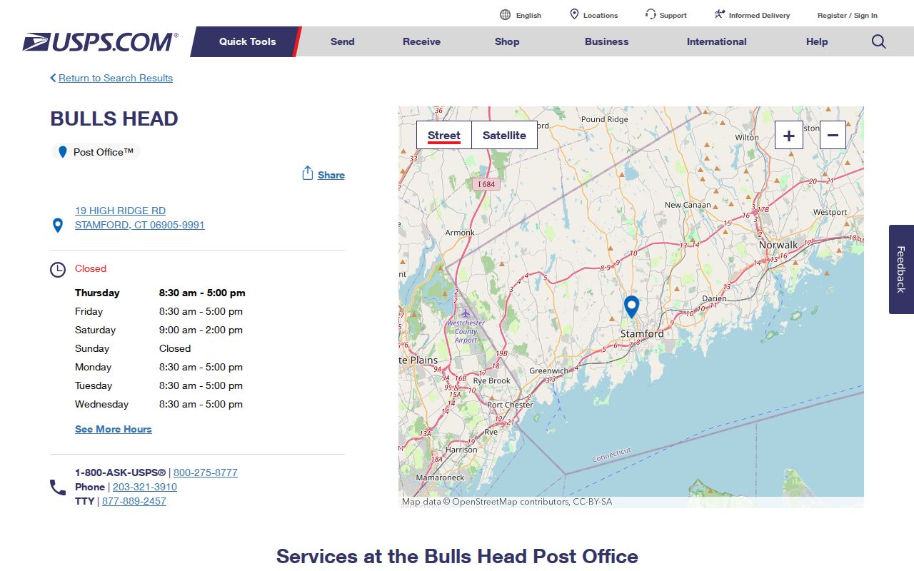
The facility views confirm an operational ZIP without defining municipal status.
Finding Stamford Residents Within One ZIP
A ZIP narrows the starting set, but Stamford’s record systems do not all accept it. Use the Stamford source that matches the question, preserve the source date, and do not treat a Stamford parcel row as a person match.
- Check the complete Stamford address in the USPS ZIP Code Lookup, including the street number, street name, city, and state.
- Query Stamford CAMA by Property_Zip or Mailing_Zip, then retain Location, PID or parcel fields instead of copying a name alone.
- Open each candidate in Stamford Vision with the address, owner, MBLU, PID, or account key. Once a ZIP narrows to a street, use the Stamford street records workflow for parcel-by-parcel work.
- Use the Stamford state voter status lookup only for an individual registration question. A public streetwide current-occupant list is not returned by that tool.
- For a defined Stamford historical or administrative extract, ask the custodian for a focused Connecticut FOI request with the ZIP, fields, date range, and record class.
USPS, Stamford CAMA, Vision, and the voter system each describe a different layer. The useful Stamford result is a joined set of keys, not a promise that every name in one layer lives at the parcel today.
The interactive USPS address lookup is the final address-to-ZIP authority captured for Stamford research.
Check the submitted result live because a city-name search cannot settle every delivery address.
Note: Stamford’s GIS map and assessor card can assemble parcels, but neither supplies a public ZIP-wide household browser.
Which Stamford Portals Accept a ZIP Key?
Stamford portal capability matters more than the word “directory.” A Stamford ZIP field may return parcel rows, a delivery answer, or nothing at all. The table separates those outcomes.
| Portal or route | ZIP capability | Result and limit |
|---|---|---|
| CT CAMA FeatureServer | Property_Zip and Mailing_Zip query | Parcel rows, fields, and geometry; not a resident roll |
| Stamford Vision assessor | No visible ZIP mode | Address, owner, account, MBLU, PID, All, street listing, and sales search |
| Stamford GIS parcel viewer | Map and query context | Parcels, addresses, districts, and overlays; no public ZIP form captured |
| Stamford MyTaxBill | No ZIP field observed | Name, property number and street, bill, account, link, tax ID, and DBA modes |
| Connecticut voter lookup | No public ZIP field captured | Individual status route; protected fields and addresses can be withheld |
| Connecticut eLicense | City, state, ZIP, and country fields | License or credential matches, not a Stamford resident list |
| Written FOI request | Requester-defined field | Ask the relevant Stamford custodian for a narrow parcel or record extract |
ZIP Codes Do Not Mark Stamford City Limits
The Stamford CAMA anomalies make the boundary rule plain. A parcel can sit in Stamford while its Property_Zip uses a neighboring postal area. A mailing ZIP can belong to an owner outside Stamford even when the taxable parcel is in the city. Stamford municipal GIS boundaries, parcel Location, deeds, and legal descriptions answer the city question. USPS answers the delivery question.
- ZIP code
- A postal routing area used to sort and deliver mail.
- ZIP+4
- A longer delivery code that narrows a ZIP to a route, building, or delivery segment.
- PO-box ZIP
- A code used for post-office box service or a special facility rather than a normal street route.
- Unique ZIP
- A postal code assigned to one large organization or institution instead of a broad neighborhood.
- Carrier route
- A delivery path used by USPS within a ZIP; it is not a municipal parcel boundary.
Boundary check. Treat a ZIP as a postal key. Confirm Stamford status with the parcel Location and the city record, especially for every 068xx CAMA row.
A Stamford ZIP Is Not a Voting District
Stamford’s voting-location tool asks for a street number and street name for an upcoming election. It returns a place or district answer, not a ZIP-wide list of voters. The Stamford Connecticut voter lookup is also an individual status route. The public registry can contain released name, residence address, district, party, status, and election-history fields, but C.G.S. §9-50d withholds sensitive identifiers and allows safety-based suppression.
A statewide file request is a separate SOTS route. It must be made in writing, costs $300, and is paid before release. A focused Stamford question should go to the Registrars at 888 Washington Boulevard, 6th Floor, or ask for a defined list-maintenance or aggregate record under C.G.S. §9-50a. Do not substitute a ZIP for a district, and do not read an absent protected address as proof that no registration exists.
The Stamford voting-location tool is the city’s address-based place check, separate from resident research.
Old Stamford Addresses Had No ZIP
Historical Stamford directories use street numbers, intersections, landmarks, and neighborhood names. Federal census schedules use enumeration districts and street addresses. Neither source can be searched safely by a modern ZIP. Start with the old Stamford street form, then use maps and parcel history to connect it to a present address.
The Stamford Lost Streets record is especially useful downtown. Meadow became Hawthorne, School became Tresser, and St John’s Place disappeared during urban renewal. Cottage, Chapel, Holly Place, and Willow also carry older map or directory clues. A Stamford ZIP code directory can sort current parcel rows, but it cannot bridge a renamed street by itself.
Limits on a Stamford ZIP-Wide Resident Search
A Stamford ZIP-wide result is technically limited by the source. Stamford CAMA can return a large parcel set and has a service maximum of 1,000 records per response. Stamford Vision has no visible ZIP selector. Stamford GIS is spatial rather than a name list. Stamford MyTaxBill has no ZIP field. The Stamford voter lookup is individual, while a statewide file requires a written request and can suppress protected records.
For a record not exposed by a Stamford portal, name the Stamford office, ZIP, parcel or street, fields, date range, and preferred format in a Connecticut FOI request. The FOI Commission guidance explains inspection, copy fees, prompt access, written denial, and appeal timing. A request cannot open a record closed by a vital-record, court, voter-privacy, or personal-identifier rule.
Use with care. Stamford public records support genealogy, property history, civic checks, and personal safety awareness. Do not use a ZIP result to track, intimidate, or harass a person.
Note: A missing name can reflect a parcel type, a suppressed field, a stale source, or a mismatch between postal and municipal keys.